Table of Contents
Key Highlights
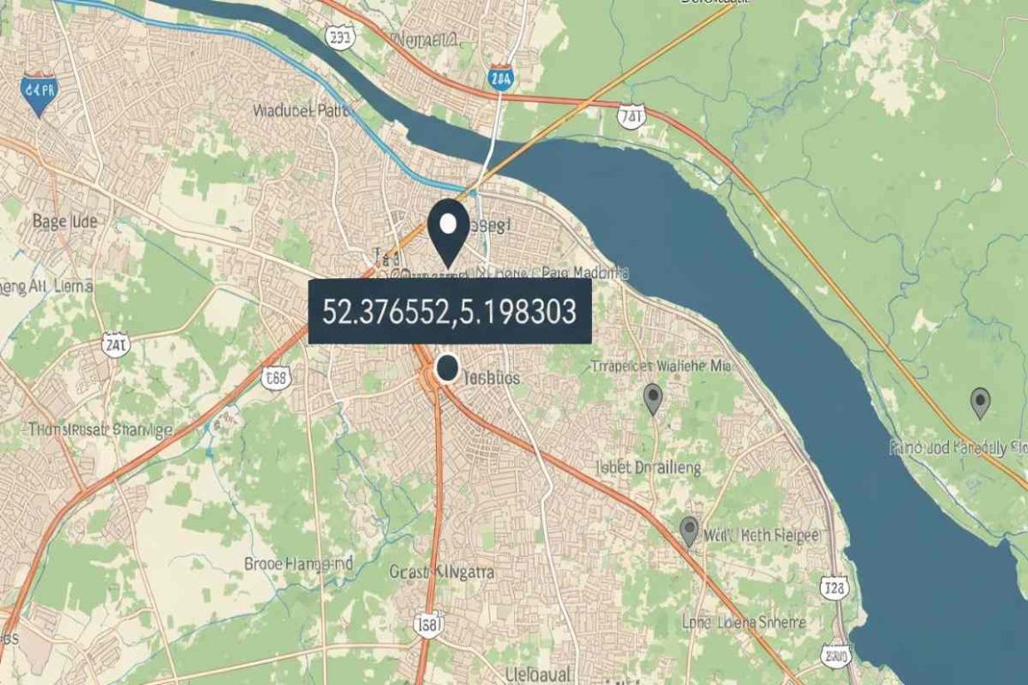
- A specific set of coordinates on Google Maps sparked a viral mystery online.
- The satellite image at 52.376552.598305 appeared to show a man dragging a body.
- This image, located in a park in the Netherlands, quickly became a viral sensation.
- Internet sleuths and fact-checkers investigated the strange Google discovery.
- The mystery was ultimately debunked; the “bloody trail” was just wet wood.
- The scene likely captured a person with their dog after a swim, not a crime.
Introduction
Have you ever stumbled upon something strange while exploring the globe from your screen? Google Maps offers a digital window to the world, but sometimes its satellite view captures more than just streets and buildings. A particular set of coordinates, 52.376552.598305, once pulled users into a startling mystery. The Google satellite image at this location seemed to show a gruesome scene, leading to wild speculation and turning a quiet park into a point of international digital intrigue.
The Mystery Behind 52.376552.598305 on Google Maps
The fascination with these specific coordinates stems from a Google satellite image that appeared to capture a chilling moment. At first glance, the picture shows what looks like a person standing over a dark red trail leading to the edge of a wooden pier, sparking a viral theory that this was evidence of a murder. Why are these Google Maps coordinates considered so mysterious? The image is ambiguous enough to let the imagination run wild.
This single satellite frame became the center of a creepy internet mystery. The story spread rapidly as a meme in April 2013, with users daring each other to enter the coordinates into Google Maps and see the “crime scene” for themselves. This viral spread cemented the location’s status as one of Google’s most unsettling discoveries. What did the image truly show, and how did the internet react?
What the Satellite Image Shows at These Coordinates
When you input the coordinates 52.376552.598305 into Google Maps, the satellite image centers on a wooden pier in Beatrixpark in Almere, Netherlands. The image, captured in 2009, shows a few figures on the pier. The controversy arises from a long, dark red streak that stains the wood, appearing to lead from the figures to the water’s edge.
This visual ambiguity led to two very different interpretations. The viral, more sinister theory suggested a person was dragging a body, leaving a trail of blood behind them. However, a more logical explanation offers a completely harmless scenario. What you see depends entirely on how you interpret the context of a public park in broad daylight.
The truth is often less dramatic than the fiction. A closer look suggests the “trail of blood” is simply water on red-stained wood, which makes it appear darker. The “culprit” is likely a wet dog. This table breaks down what can be seen at these coordinates on Google Maps.
| Ominous Interpretation | Plausible Explanation |
|---|---|
| A person dragging a body to a lake. | Two people enjoying a day at the park. |
| A trail of blood left on the pier. | Water dripped from a wet dog onto the wood. |
| A furtive crime caught by a Google satellite. | A dog, possibly a chocolate Labrador, shaking off water. |
The Viral Spread and Social Media Reactions
The image from these Google coordinates became a viral sensation primarily through social media and forums in April 2013. A meme circulated widely, challenging users to type the numbers into Google Maps to witness what was described as a man disposing of a body in a lake. This simple, sharable instruction was perfect for generating buzz and curiosity.
The reactions from internet users were a mix of horror, excitement, and skepticism. Did this Google Earth image at 52.376552.598305 become viral on social media? Absolutely. It was a classic internet mystery that anyone with a computer could “investigate” for themselves. The narrative was compelling, and the visual “evidence” was just a click away, making it easy to share and discuss.
Internet users had plenty to say about the 52.376552.5983053 coordinates. Common reactions and theories included:
- Belief in the Crime: Many users were convinced they were looking at a real crime scene caught on camera.
- Skepticism and Debate: Others immediately questioned the logic of committing such an act in a public park in daylight.
- The “Wet Dog” Theory: The most popular counter-theory, suggesting a dog and water, quickly gained traction among more critical thinkers.
- Sharing and Memes: The image was widely shared with captions like “Google Maps catches a murder.”
Unraveling the Truth: Debunking the “Body Dragging” Theory
So, is it true that a man is dragging a body at 52.376552.598305 on Google Earth? The answer is a definitive no. Fact-checkers, like David Mikkelson of Snopes, quickly pointed out the flaws in the sinister theory. The context of the scene makes a crime highly improbable. Disposing of a body in a public park, in broad daylight, while leaving an obvious trail, simply defies logic.
The more comprehensive view of the Google Maps satellite image helps debunk the claim. There is no “bloody” trail leading up to the wooden pier itself, only on it. The most accepted explanation is that the image shows a couple of people with their dark brown dog, perhaps a chocolate Labrador. The supposed blood trail is just water darkening the red-stained wood after the dog likely took a swim and dripped water as it walked back.
Ultimately, the scene at 52.376552.598305 has been thoroughly explained as a harmless optical illusion. The combination of water, stained wood, and the low resolution of a satellite image created a scene ripe for misinterpretation. While local police were reportedly sent the picture, it was taken by Google in 2009, leaving no evidence to investigate years later.
Conclusion
In conclusion, the coordinates 52.376552, 5.198303 have sparked curiosity and speculation across the internet, revealing our fascination with the mysteries of the world around us. The satellite imagery and social media reactions highlight how a simple set of numbers can lead to widespread intrigue and debate. While theories such as the “body dragging” claim can often overshadow the factual explanation, it’s crucial to approach such mysteries with a critical eye and a sense of adventure. Whether you’re planning to visit the location or simply enjoy the stories that arise from it, there’s no denying that exploring these coordinates brings a unique blend of excitement and inquiry.
Frequently Asked Questions
Where is 52.376552.598305 located and can you visit it?
These Google Maps coordinates point to a wooden pier in Beatrixpark, a public park located in Almere, Netherlands. Since it is a public space, you can certainly visit the location in person and see the infamous pier for yourself.
Has there been an official explanation for what’s visible in the image?
There has been no official statement from Google about the satellite image. While local police were notified, the image was from 2009, so no active investigation was launched. The most widely accepted explanation comes from fact-checking websites that have debunked the crime theory.
Are there other mysterious or creepy Google Maps locations like this one?
Yes, Google Maps is full of other mysterious coordinates and creepy locations discovered by users. From supposed giant snake skeletons to sunken cars and strange patterns in the desert, there are many other oddities you can explore from your computer.